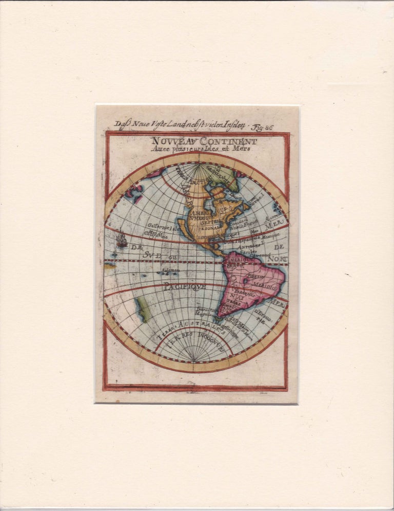
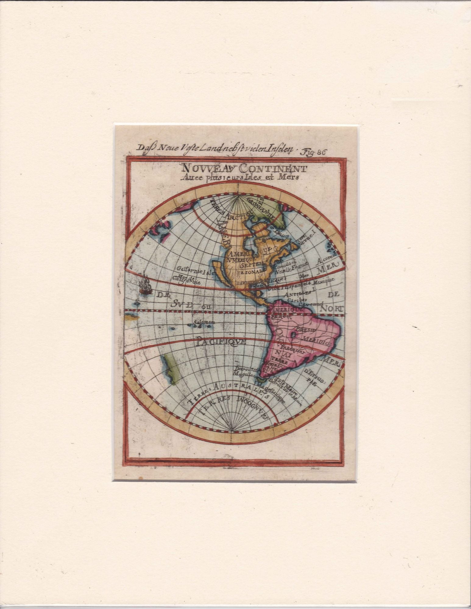
New Continent Map Depicting The New world with California as an Island, by Mallet 1685
Posters, Broadsides, Prints, Maps, &
Mallet, Allain Manesson. Nouveau Continent Avec Plusiers Isles et Mers, 1685, documents seventeenth-century European geographic knowledge of the Americas, including the widely circulated misconception of California as an island. Produced within the context of expanding French engagement with global exploration and imperial geography, the map records how information from Spanish voyages, missionary reports, and speculative cartographic traditions circulated across Europe. The depiction of “Californie Isle” reflects a persistent geographic error that shaped European understanding of North America well into the eighteenth century, while inscriptions such as “Terres Incognues” mark the limits of mapped knowledge. The engraving supports research into early modern cartography, colonial knowledge production, and the transmission of geographic information during the age of exploration.Mallet, Allain Manesson. Description de L’Univers. Paris: Denys Thierry, 1685. Copper engraving identified as Figure 86, later hand-colored. Map measures approximately 4.5" x 6.5", presented in a mat measuring 8.5" x 11". The composition depicts North and South America with labeled regions including “Amerique,” “N. Mexique Septentrionale,” “Californie Isle,” “Mer de Californie,” “Magellanique,” “Terres Arctiques,” “Terres Australes,” and “Terres Incognues.” A small engraved ship appears in the Pacific Ocean, reinforcing the maritime orientation of early modern geographic representation. The map’s decorative and schematic elements align with Mallet’s broader project of synthesizing global geographic knowledge for a European readership.
Issued during a period when European cartographers attempted to reconcile exploration accounts with inherited classical geography, the map demonstrates how conjecture and observation coexisted within printed atlases. Mallet’s work contributed to the dissemination of geographic ideas among educated audiences in France and beyond, shaping perceptions of the Americas as both mapped and unknown territories. The persistence of the California-as-island depiction underscores the slow correction of geographic error despite ongoing exploration, making the map a useful document for studying the evolution of cartographic knowledge. Light scuffing to mat; engraving clean and well-preserved; overall in very good condition.
Item #14194
Price: $850.00
See all items in Western Americana, Other (American History), California, World Culture & Travel
See all items in American History & Americana, American History by State, International & Global Culture
See all items by California as an Island Cartography Mallet
Suggested Other (American History)Browse All







Suggested Western AmericanaBrowse All




Suggested CaliforniaBrowse All





Suggested American History by StateBrowse All