Early Modern Cartography of the Americas Ogier Engravings of Nouvelle France and Spanish Colonial Territories 1699
Map
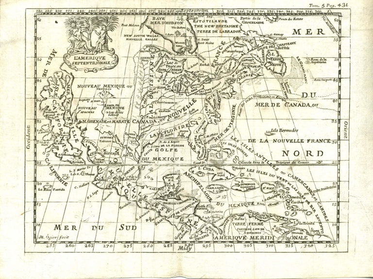
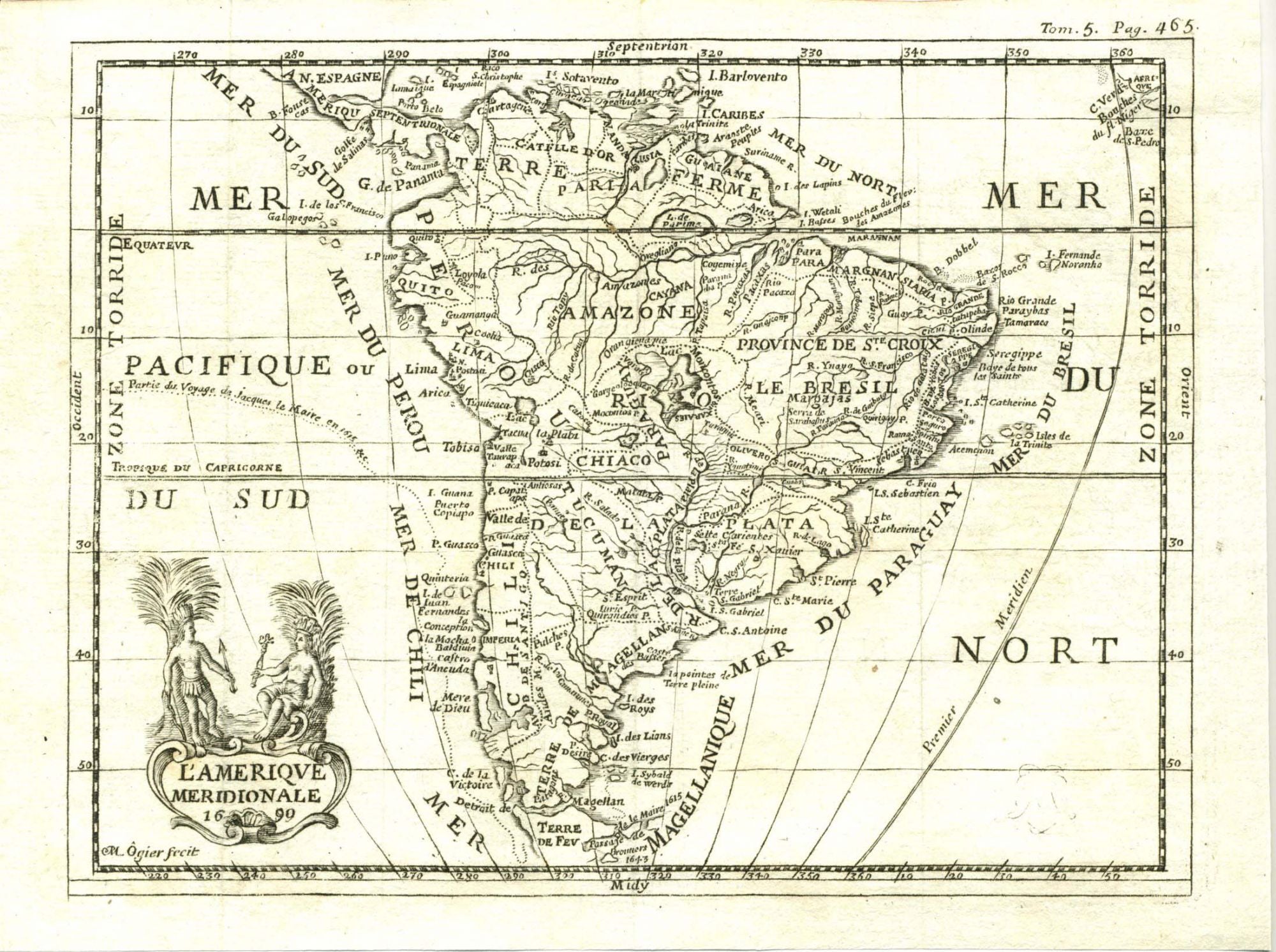
Ogier, M. L’Amerique Septentrionale and L’Amerique Meridionale, 1699, document European cartographic knowledge and imperial territorial claims in the Western Hemisphere at the end of the seventeenth century. Produced within the context of French and Spanish colonial expansion, the maps support research into early modern geography, imperial competition, and the transmission of exploration data into printed form. They provide evidence of how European mapmakers synthesized reports from explorers, missionaries, and colonial administrators into visual representations of space, including regions that remained only partially surveyed.Ogier, M. L’Amerique Septentrionale. [France]: 1699. Engraved map, approximately 8 x 6 inches. Companion: Ogier, M. L’Amerique Meridionale. [France]: 1699. Engraved map, approximately 8 x 6 inches. The northern map depicts the eastern portion of North America dominated by the designation Nouvelle France, with river systems extending from the Great Lakes through the Mississippi basin. Florida curves inward toward the Gulf of Mexico, and California appears as a large island separated from the mainland along the Pacific coast, reflecting a widely circulated seventeenth-century cartographic convention. The Caribbean islands are densely labeled, with Bermuda positioned in the Atlantic east of the continental coastline. The southern map presents South America with colonial regions identified as Le Bresil, Perou, and Paraguay. The Amazon basin occupies the central interior, while the Strait of Magellan marks the southern maritime passage between oceans. Both engravings include latitude and longitude grids and decorative cartouches incorporating Indigenous figures set within tropical landscapes.
These maps were issued during a period when European geographic knowledge remained uneven, with coastal regions more precisely rendered than inland territories. The persistence of California as an island demonstrates the durability of early exploratory errors within European cartography, while generalized interior features in both North and South America indicate limited direct survey data. At the same time, the detailed labeling of colonial regions and Caribbean islands reflects the economic and strategic importance of Atlantic trade networks. Together, the pair offers material evidence of how geographic knowledge functioned within imperial frameworks at the close of the seventeenth century. Light age toning and minor edge wear; overall very good condition.
Item #10220
Price: $480.00
See all items in Other (American History), California, Mexico, South & Central America
See all items in American History & Americana, American History by State, International & Global Culture
See all items by Colonial Americas
See all items in California
Suggested Other (American History)Browse All


Suggested Mexico, South & Central AmericaBrowse All


Suggested CaliforniaBrowse All


Suggested American History & AmericanaBrowse All