Arabian Peninsula and Persian Gulf Cartography, Jacques Bellin’s 1740 Carte de la Coste D’Arabie, Mer Rouge, et Golfe de Perse
Posters, Broadsides, Prints, Maps, &
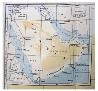
Bellin, Jacques-Nicolas, Carte de la Coste D’Arabie, Mer Rouge, et Golfe de Perse, 1740, documents French cartographic knowledge of Arabia, the Red Sea, and the Persian Gulf during a period when European naval, commercial, and imperial interests depended on increasingly detailed coastal mapping. The map is significant for research into eighteenth-century European geography of the Arabian Peninsula, maritime routes between the Red Sea and Indian Ocean, and the representation of Gulf place names before modern national borders fixed the region’s political geography. Bellin was a French cartographer and hydrographer associated with official marine mapping, and this map is identified by the Library of Congress as a 1740 work published under the order of Jean-Frédéric Phélypeaux, Count of Maurepas.Carte de la Coste D’Arabie, Mer Rouge, et Golfe de Perse. Jacques-Nicolas Bellin. Paris: published by order of the Comte de Maurepas, 1740. Copper engraving, approximately 11.5 by 10 inches. The map covers the Arabian coast, Red Sea, Persian Gulf, Gulf of Oman, and surrounding regions, with the Persian Gulf occupying the upper right portion and with Bahrain, pearl-bank references, and the Strait of Ormus/Hormuz identified within the Gulf geography. The sheet emphasizes coastlines, islands, straits, and maritime approaches rather than inland political boundaries, making it especially useful for studying how European mapmakers organized the region around navigation, littoral settlement, and strategic waterways. Other institutional and map-dealer records identify the map as depicting the Arabian Peninsula, Red Sea, and Persian Gulf, with coastal place names extending from Egypt and the Red Sea toward the Gulf of Oman.
The map belongs to the French hydrographic tradition of the early eighteenth century, when printed maps translated naval intelligence and earlier geographic sources into portable reference works for readers interested in commerce, travel, and empire. Its omission of Qatar as a named political unit should be understood in relation to eighteenth-century European cartographic conventions rather than as evidence of the area’s absence from Gulf history. Two vertical folds, with minor handling wear; overall very good. A strong example of Bellin’s Gulf and Red Sea cartography, offering concrete evidence of how Arabia, Bahrain, and the Strait of Ormus were mapped for European audiences in 1740.
Item #14470
Price: $450.00
See all items in Arabia, Middle East
See all items in International & Global Culture
See all items by Jacques Bellin Middle East Map
See all items in Middle East
Suggested Middle EastBrowse All



Suggested ArabiaBrowse All