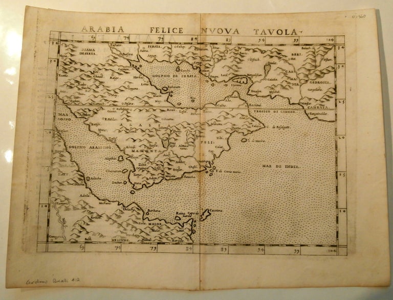
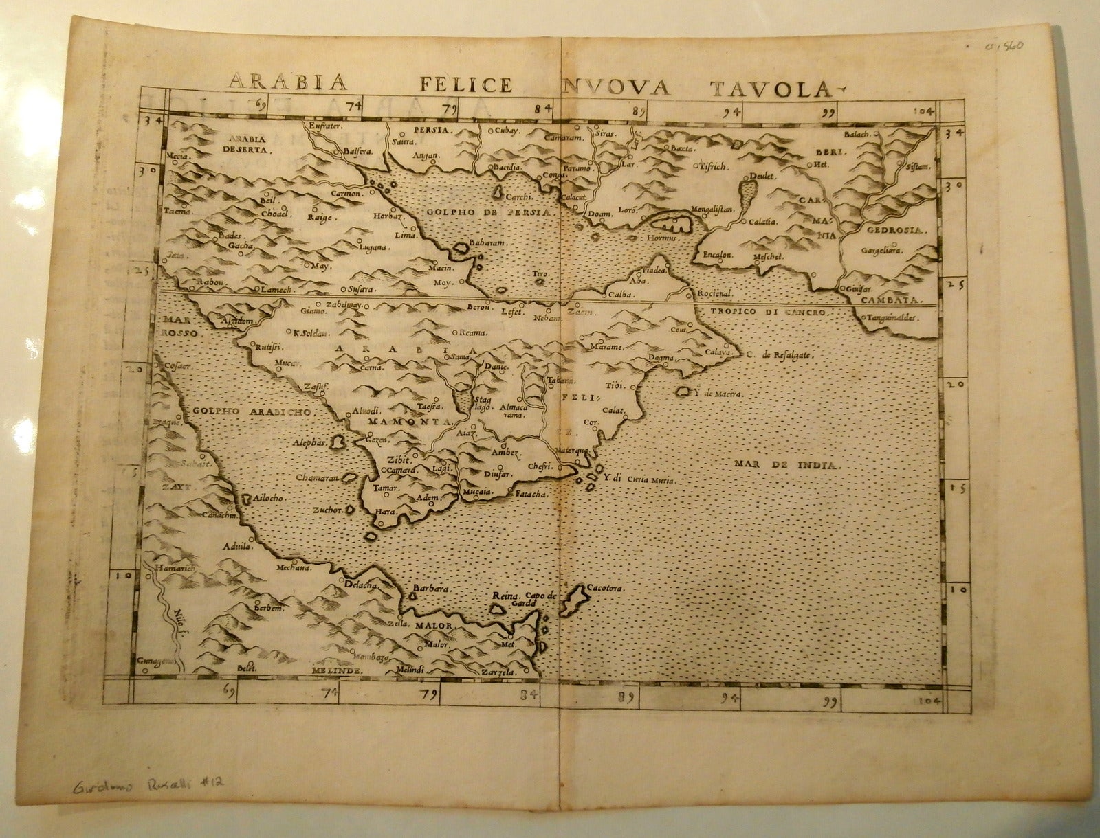
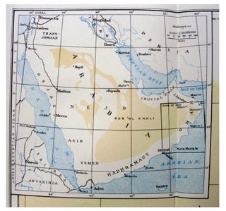
Sixteenth Century Mapping of the Persian Gulf: “Arabia Felice Nuova Tavola” Depicting Bahrain, Qatar, and Abu Dhabi
Posters, Broadsides, Prints, Maps, &
Ruscelli, Girolamo. Arabia Felice Nuova Tavola, 1561, engraved map presenting one of the earliest modern cartographic depictions of the Arabian Peninsula during the Renaissance expansion of geographic knowledge. Ruscelli, an Italian humanist and cartographer active in Venice, produced this map as part of the sixteenth century revival and reinterpretation of the geographic tradition associated with Claudius Ptolemy. Drawing on the influential 1548 map designed by the Italian cartographer Giacomo Gastaldi, Ruscelli’s engraving incorporates updated geographic understanding of the Persian Gulf and Arabian Peninsula that emerged from European contact with the eastern Mediterranean and Indian Ocean trade routes. The map marks an early modern effort to systematize geographic knowledge of Arabia within the expanding cartographic traditions of Renaissance Europe.Ruscelli, Girolamo. Arabia Felice Nuova Tavola. Venice, 1561. Engraved copperplate map derived from Giacomo Gastaldi’s earlier geographic model of the region. The map depicts the Arabian Peninsula and surrounding waters of the Persian Gulf with labeled settlements and coastal formations. Notable place names include Baharam, corresponding to Bahrain, along with Aba, associated with Abu Dhabi, and Qatar, whose geographic formation appears clearly delineated. Ruscelli’s map belongs to a generation of Renaissance cartography that adopted copperplate engraving in place of earlier woodcut techniques, allowing greater precision in the rendering of coastlines, settlements, and geographic detail.
During the sixteenth century Venice emerged as one of Europe’s most important centers of cartographic production, where printers and engravers integrated classical geographic traditions with newly circulating information derived from trade, diplomacy, and exploration. Cartographers such as Gastaldi and Ruscelli played a central role in refining printed maps through improved engraving techniques and updated geographic data. Maps of the Arabian Peninsula held particular importance for European audiences because the region lay along the maritime routes linking the Mediterranean world with the Indian Ocean trading system. Ruscelli’s engraved rendering of Arabia thus reflects both Renaissance scholarly interest in classical geography and the growing European engagement with the broader commercial networks of the early modern world. Sheet measuring approximately 9 x 11 1/2 inches. Light age toning and minor handling wear; overall very good condition. A significant example of sixteenth century printed cartography depicting the Arabian Peninsula.
Item #14460
Price: $750.00
See all items in Arabia, Middle East
See all items in International & Global Culture
See all items by 1561 Map
See all items in Arabia
Suggested ArabiaBrowse All


Suggested Middle EastBrowse All


Suggested International & Global CultureBrowse All