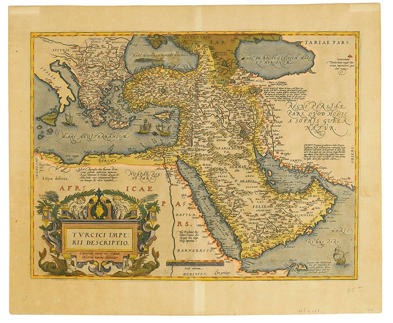
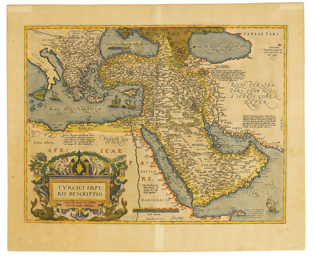
A.Ortelius Map of Holy Land, Arabia and Turkey and Greece Circa 1609
Map
ORTELIUS, Abraham. Turcici Imperii Descriptio. Double-page engraved map, 18x22", wide margins, Latin text on verso; hand-colored with oxidation of verdigris pigment. Map of Arabia and Turkey and Greece Circa 1609. With many details, notably, this map labels the Gulf as "Mare Elcatif" in the northern sector and "Sinus Persicus" to the south. While maps frequently designate the Gulf as "Sinus Persicus" during the period, "Mare Elcatif" is more rare and draws its name from the Elcatif desert region lying just inland and south of Qatar. Four ships sail the seas throughout the map and a beautiful illustration of two cherubs and two sirens is engraved in the bottom left corner with the words "Turcici Imperii Descriptio. Moderate toning, remnants of canvas tabs on upper corners verso. Van den Broecke 169. [Antwerp, circa 1609].Item #14482
Price: $1,200.00
See all items in
Maps and Travel,
Middle East and Asia
See all items by Map Ortelius
SUGGESTED ITEMS