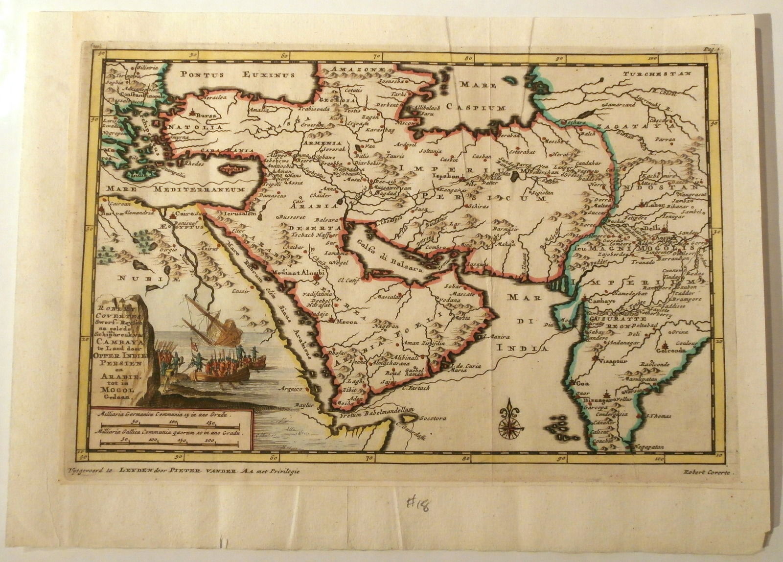
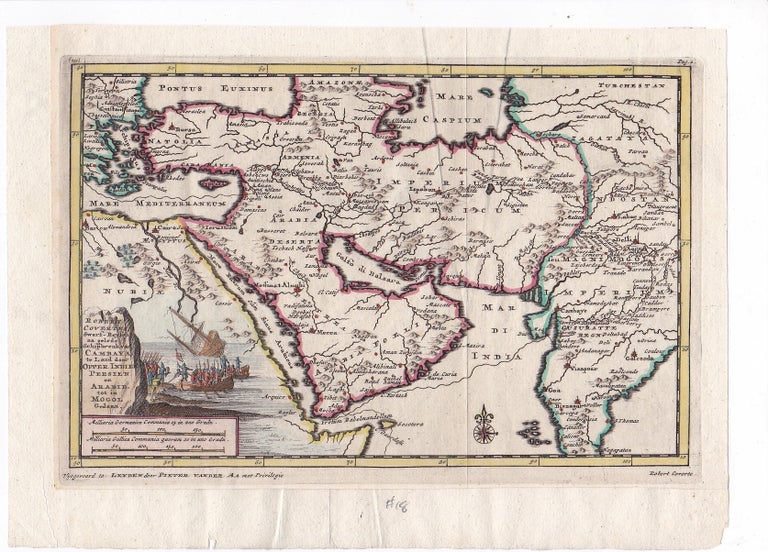
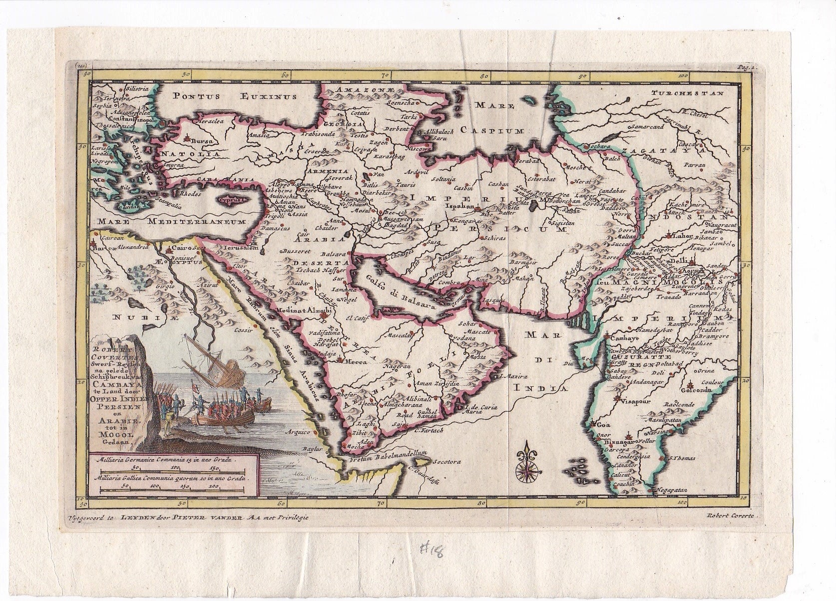
1705 Original Map of Jerusalem, Turkey, Arabia, Persia, and India by Pieter Van Der AA, Illustrated with a Shipwreck
Map
A beautiful copper engraved, hand-colored map of the Arabian Peninsula, Persia, Iran, Turkey, and India from 1705 by famous Dutch publisher Pieter Van Der AA (1659-1733). Map size 6.5" x 9.5" with wide blank margins. Next to the cartouche, in th left hand corner is an ornate illustration of a British voyage in1609, as told by Robert Covertes, which resulted in shipwreck. In the center of the map is the Arabian Peninsula with the Golfo di Balsara, and notes the cities of Medina, Mecca, and Sohar, Mascate, and El Catif along the Arabian coast. We can see the island of Bahrain, which is oversized and the peninsula of Qatar is totally missing.The map shows the complete Arabian Pennisula at its center and covers the area from Constantinopole to India. In very good condition.Item #14469
Price: $750.00
See all items in
International items,
Maps and Travel,
Middle East and Asia,
Religion and Philosophy
See all items by Pieter Van Der AA
SUGGESTED ITEMS