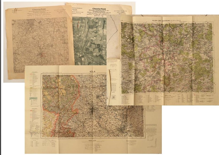
Collection of 10 German-made WWII-era maps of cities and Factories
Map
Collection of 10 German-made WWII-era maps. All printed in German, sometimes with foreign translations.Includes arial bombing maps of Chesterfield Tube Works, Great Britain (Dec. 1942), showing a geographical arial photograph of the factory area, and an overlay of roads, bridges and potential targets. The German forces tried to bomb Chesterfield and the railway tracks nearby, where the Tube Works produced important cylinders and compressors for the war effort. Instead, their bomb fell on a golf course 4 miles away, doing no harm. Bears the warning: "Nur fur den Diensfgebrauch" or "For Internal Use Only." 12"x12.5" (2 pg)
Also includes a "Map of the Former Czechoslovakia" (In German: "Karte der ehemaligen Tschechoslowakei"). The German occupation of Czechoslovakia lasted from1938 to 1945, beginning with the Nazi annexation of the northern and western border regions, known collectively as the Sudetenland, under terms outlined by the Munich Agreement. Hitler's pretext for this effort was the alleged privations suffered by the ethnic German population living in those regions. Czechoslovakia was finally liberated with the Allied Victory in 1945. Map in black and white with red elevations. Bears the large tage at the top: "Sondersausgabe!" or "Special Edition!" Also includes a map of a Czech city which played an important part in World War II History. Situated at the very end of the Sudentenland, the borders of the Third Reich were literally on Plzen's outer limits. Occupied by Nazi forces starting in 1939, and divided by the loyalties of its half-German population, Plzen was finally liberated with the rest of Czechoslovakia in 1945. The map is written in German with Czech translation of each heading. It has seen substantial use and the key has been cut out of the upper left side. 37"x27"
Koln - German map - Near mint condition. 22x17". Translates to "Cologne" which is a city in Germany.
Umgebung von Wein - German. 44x34"
"Deutschesreich" translates to "German Empire"- western half- 56x42" extra large German map - over outline map - no date
Frankreich - same as German Empire. Shows paris and london.
Italien - same as above.
"Blatt Sudost" Translates to "Southeast Sheet" - Ubersichtskarte translates to "Overview Map" - 56x42". Color. Attractive gold, pink, and blue. 1:1,000,000.See photos. no date. Very nice condition on printed side.
Item #14430
Price: $800.00
SUGGESTED ITEMS