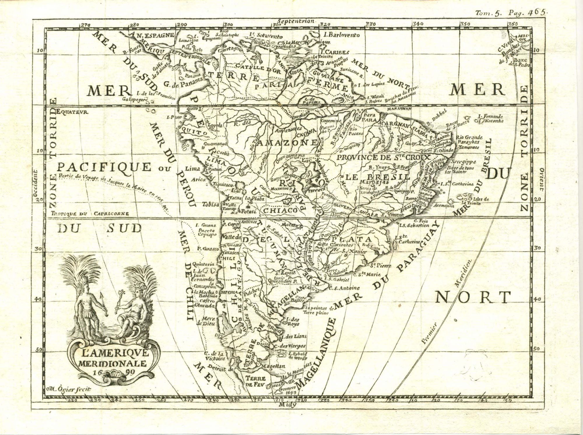
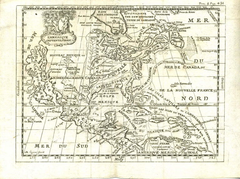
1690 Map of North And South America, Showing California As An Island and Many Other Distortions
Map
Two beautiful 17th century maps of North and South America. Both engraved by "M. Ogier", in French. Each about 8 x 6", Dated 1690, two truly historic beautifully detailed very early maps. One is titled "L'AMERIQUE Septentrionale." in a cartouche with a woman with sword and man. The other one "L'AMERIQUE MERIDIONALE." in a cartouche with two indigenous people holding an arrow and a tomahawk, flanked by palm trees. What makes these 2 maps fascinating is the erroneous geographical knowledge of the 17th Century. North America and Canada are on the first map titled "L'AMERIQUE Septentrionale". Greenland touching Canada on top and California is depicted as a large island in the West, upper tip of the California islands is higher than Lake Erie or New York. Since the map predates Lewis and Clark by over 100 years, it is missing Utah's Great Salt Lake, and has disproportionately smaller western United States. The Northwest is basically blank. Florida's tip bends inward toward the Gulf. A truly fascinating map.Also included is a separate 1690 map of Map of South America from the same Atlas by "M. Ogier", Titled "L'AMERIQUE MERIDIONALE." in an attractive cartouche with two Indigenous Indians. Here errors include the absence of the Andes. The formation of South America itself is somewhat flattened and shorter, significantly reduced is the southern tip of South America. Two great 1690 maps of the Americas. Both maps are in excellent condition. $500.
Item #10220
Price: $500.00
See all items by 1690s Map America
SUGGESTED ITEMS