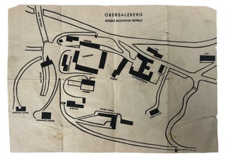
1945 Official U.S. Army Map of Obersalzberg Hitler's Mountain Retreat
[WWII] Official 1945 U.S. army map of the Obersalzberg nazi compound. Measures 8" x 11.75". These maps were published and distributed by the U.S. army prior to American occupation so soldiers could navigate the territory, hence the inaccuracies of the layout as they were not yet on the ground. The.....